|
Published:
Citizen science breaks new ground
With a history of declining investment in research programs, resources for ongoing scientific monitoring of environmentally sensitive regions within Australia have been limited. But thanks to technology and a growing number of community-based volunteer monitoring groups, enriched environmental data is being collected on a scale that was inconceivable 15 years ago. The question is how we make use of it. Rachel Sullivan reports.
From monitoring the weather, to testing for acidic soils, or counting koalas and tree-kangaroos in the backyard, recording frog calls in ephemeral swamps and searching for sea dragons off the southern Australian coast, people from all over the country are helping to build a comprehensive picture of the changing state of our environment.
Community environmental monitoring (CEM) has a long history in Australia: the Bureau of Meteorology has been using volunteers to collect rainfall data for more than 100 years, while the information in the respected Atlas of Australian Birds is based almost entirely on 5.5 million observations made by amateur birdwatchers.
In recent years growing public awareness of environmental issues relating to land care, conservation and catchment management has brought together scientists, government agencies, academics, concerned residents and landholders in active groups across the country. This burgeoning interest is a worldwide phenomenon, with both multi-national programs like Reefcheck and Earthwatch and local programs such as wetland monitoring in Namibia, birdwatching in the UK and pollution monitoring in India all adding up to useful capacity in the ongoing need to collect data across vast geographic areas.
Coupled with an explosion in the availability of off-the-shelf technologies, such as mobile phones, GPS systems, digital cameras and the Internet, community groups now have an unprecedented ability to accurately log and record the data they gather and to effect real change in the environments in their care.
‘Monitoring the environment is part of who we are,’ says Jason Alexandra, one-time head of Earthwatch and now General Manager Basin Program Implementation at the Murray–Darling Basin Authority. He also co-authored ‘Listening to the land’, a report which catalogued community environment monitoring groups in the mid-1990s. At that time it was estimated that there were around 150 000 people involved, but that number has since risen dramatically, with approximately 300 000 people regularly involved in Frogwatch, Saltwatch and Streamwatch alone.
‘Observing patterns in nature is part of the set of skills that helped us survive in the wild, and still help us survive in today’s urban jungle,’ Alexandra says. ‘Although our modern lifestyles tend to insulate us from nature, there is enormous enthusiasm in the community for observing and monitoring events and changes in the environment, and there are a lot of networks that occur outside any government support.’
He says community engagement in these programs has two tiers of benefits: the contributions the huge observational effort makes to environmental science, and education of the people involved.
Andrew Campbell, formerly involved with Landcare and Land and Water Australia, is now Managing Director of sustainability consultants, Triple Helix. He agrees with Alexandra, believing that CEM programs help the community become more scientifically literate.
‘As the recent bushfire events in Victoria showed, people need to have a better understanding of critical factors like the Forest Fire Danger Index.’ He believes if people had better understood that this was at unprecedented levels, they may have heeded the warnings from fire authorities before 7 February more seriously.
‘The process of collecting and analysing local data encourages people to ask more intelligent questions of higher data, big issues such as climate change figures, and to get it into a more sensible perspective,’ he observes. ‘This helps them to get a better perspective on these big issues.’
One of the most interesting things about environment monitoring programs is the flow-on educational benefits, he says, particularly with those like Waterwatch which involve schools. ‘The parents and teachers usually learn as much as the kids, so the learning permeates the wider community,’ he says.
|
|
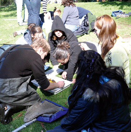
John Gooderham, waterbug expert, shows keen Waterwatch volunteers how to sort and classify different species. Credit: Waterwatch Victoria, Department of Environment and Sustainability
|
Waterwatch is one of Australia’s best-known CEM programs. Established in 1993, there are now nearly 3000 Waterwatch groups monitoring water quality at over 7000 sites in 200 catchments across Australia. Comprising individuals, community and school groups supported by trained coordinators, Waterwatch members conduct biological and habitat assessments as well as water quality tests to determine whether the local waterway’s health is improving, stable or in decline.
In Victoria, the program has more than 91 000 participants as part of the schools education component, as well as 2329 volunteers regularly monitoring water quality at 2000 sites across the state.
According to Victoria Penko, Strategic Engagement Manager for the Victorian Department of Sustainability and Environment’s River Health Program, Waterwatch’s work is not just about water quality monitoring.
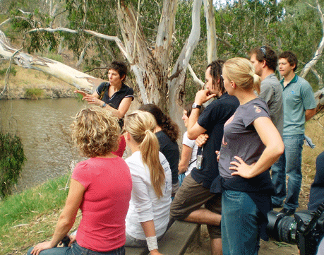
‘Volunteers learn about aquatic ecosystems and how the various elements of river systems work together,’ she says. ‘Because of their extensive environmental sampling experience, Victorian Waterwatch volunteers are also currently monitoring the effects of the bushfires and collecting and testing acid sulphate soils for the Murray–Darling Basin Authority. Drought refuge photo-point monitoring is also being undertaken by coordinators,’ she says. Photo-point monitoring is a standardised procedure for taking precisely replicable photographs of resources that require long-term management. It helps resource managers to detect subtle changes in the landscape over time.
Concerns are occasionally voiced by the scientific community that the quality of data collected by amateurs may be unreliable. However, ‘over the past five years Waterwatch has done a lot to improve data confidence,’ comments Penko. ‘We have developed a statewide data confidence framework, supported by regional data confidence plans, and undertake mystery testing to ensure the samples being collected meet QA/QC standards.’
Because of its rigid protocols, Waterwatch data is used by the Department of Sustainability and by Catchment Management Authorities in Victoria, as well as the official Index of Stream Conditions for the state.
Despite the richness of the insights it might possess, much of the data collected by other CEM groups across the country is unfortunately only used locally by councils and residents’ groups, or disappears into archives. This is partly because there is currently no centralised repository where community data is stored, or any single entity that keeps track of the many potentially more widely valuable CEM projects underway across the country.
Data gathering under the microscope
‘Volunteer groups are very keen to produce robust, rigorous, properly collected information that feeds into something bigger, and has a significant impact, such as the State of the Environment Report,’ says Andrew Campbell.
‘Any modern data management system deletes statistical outliers and raises red flags for unusual data. Good systems produce good data,’ he continues, adding that with the proliferation of inexpensive off-the-shelf technologies, such as phones and digital cameras with inbuilt GPS systems in almost every household, the possibility for fine-grained datasets with accurate spatial information at low cost is enormous.
‘Harnessing these inexpensive consumer technologies into a proper knowledge framework is becoming easier. Combined with Internet-based programs that use rigid protocols to collect and manipulate the data, we have a real opportunity to build environmental management systems that combine institutionally generated data with the richness of information that can only be generated by people living at the local level.’
The key is developing robust, scientifically valid data gathering methodologies, but these can vary widely depending on what is being monitored.
‘Community monitoring generally works well for things that need to be measured or counted, but biodiversity assessments are orders of magnitude more esoteric,’ says John Gooderham, author of The Waterbug Book, and the driving force behind a pilot project to boost the invertebrate species recognition powers of Waterwatch Victoria volunteers.
‘The balance of good bugs and bad bugs in a waterway helps score the health of a river,’ he says. ‘But not everyone who gives up their Saturday to test water quality has a microscope or the ability to use a taxonomic key.
‘When we put it to the test, we found that using basic observation and keys, people can recognise differences at a range of taxonomic levels, but not necessarily those at the arbitrarily defined Family level boundary for classification that is required in water quality evaluations,’ he says.
If, after training, participants can consistently and correctly identify species, families or orders by sight, then Gooderham believes that information should be able to be used even if it covers several different taxonomic levels.
‘This “Agreed Level Taxonomy” approach will hopefully allow community monitors involved in freshwater invertebrate surveys to pick up coarse impacts without the need for microscopes.’
Professor David Lindenmayer from the ANU’s Fenner School for the Environment is one scientist who is keen to use the volumes of data generated by dedicated enthusiastic amateurs. He believes a customised approach to data gathering in different environments may be necessary to control for differences between observers, and to ensure the data gathered is scientifically robust. In a pilot study of bird observer behaviour1 he found that appraisals of field methods, and controlling for differences between observers, are important for projects that require input from many different participants.
Into the net
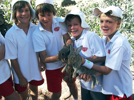
Rabbits are making a comeback, and so are the efforts to stop them. But since the accidental release of Calicivirus in the mid-1990s and subsequent decimation of rabbit populations, scientists and funding devoted to the rabbit problem have moved on, and there are now few resources available to keep track of rabbits’ resurgence. Enter the RabbitScan Challenge, a nationwide rabbit-monitoring program, which went live on May 1.
‘We are asking Australians to look for rabbits (or evidence of their presence like burrows, dung and vegetation damage) in their local area, then report their findings to RabbitScan over the Internet or via SMS,’ says Jenny Quealy, RabbitScan Project Manager. ‘The program modifies the scientific process into something everyone can do, but still obtains valid scientific data that can be evaluated by professionals.’
‘There simply isn’t enough capacity or funding and resources in agencies and the formal scientific community to achieve what the community can,’ says Quealy, who became involved in CEM through the Great Australian Dung Beetle Challenge several years ago.

|
|
An Earthwatch volunteer photographing a whale shark at Ningaloo, WA. Credit: Steve Lindfield/ECOCEAN
|
|
|
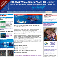
ECOCEAN is pioneering citizen science participation around the world for the sake of whale sharks. Credit: ECOCEAN
|
‘Communities are alert to changes when they happen, so we thought “Why not ask them?”,’ she comments. ‘Then we found Google’s Community Mapper tool, which was established to help people in developing countries notice and report instances of bird flu, and we thought that since most Australians are connected to the Internet, it would be a great way to efficiently and accurately gather large volumes of data.’
Another Internet-based project that is having significant impact is ECOCEAN’s Whale Shark Photo-identification project. As has been previously reported in ECOS, tourists snorkelling and diving alongside whale sharks take a photo of the area behind the whale shark’s gills then upload this image onto ECOCEAN’s website. Using technology that was pioneered to help the Hubble telescope map stars in unexplored galaxies, the program scans the new image against 20 000 others in the library, and records the return of an individual or a new sighting.
‘Apart from raising awareness about sharks and marine conservation, the program also keeps observers posted about the progress of the whale shark they sighted, sending them an email when the shark is sighted in future,’ says Brad Norman, ECOCEAN’s founder. ‘This way their data doesn’t just disappear into a black hole. People continue to be involved in whale shark conservation long after their initial dive.’
ECOCEAN’s freely available system is now being adapted to non-invasively monitor other spotty wildlife species, including leopards, cheetah, turtles and even polar bears (distinguished by their individual whisker-spot patterns).
‘Besides showing that whale shark numbers increase when they are protected,2 this program demonstrates the power of citizen science, that ordinary people around the world can make a real contribution to serious research and conservation,’ he adds.
Jason Alexandra agrees. ‘Citizen science has the potential to accumulate ecological data across unprecedented scales and with considerable economy. New approaches to data gathering, trend assessment and model testing across enormous scales are possible.
He also believes that government agencies and scientific researchers have a rich observational resource that is yet to be fully tapped.
‘These groups are ideally placed to monitor regional and national patterns such as those caused by climate change. By involving them in significant monitoring programs, these networks will play an important role in education and natural resource management, and increase society’s capacity to understand, manage and respond to change.’
1 Cunningham RB, Lindenmayer DB, Nix HA and Lindenmayer BD (1999) Quantifying observer heterogeneity in bird counts. Australian Journal of Ecology 24(3), 270–277.
2 Homberg J, Norman B and Arzoumanian Z (2009) Estimating population size, structure, and residency time for whale sharks Rhincodon typus through collaborative photo-identification.
Endangered Species Research 7, 39–53. www.int-res.com/articles/esr2009/7/n007p039.pdf


