|
Published: 18 June 2012
Science arms islands for a changing climate
The projected effects of climate change may seem abstract to those of us living in Australia, where changes like sea-level rise will take time to manifest. But for those living on small Pacific island nations, the impacts of climate change are predicted to be more serious and happen sooner. In some cases, they have already started.
|
|
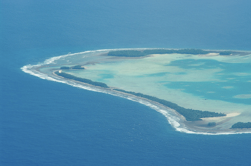
In the frontline of climate change, Pacific island nations likeTuvalu – a group of nine tiny, flat islands in the southwest Pacific – are turning to science to help them prepare for the future. Credit: Tomoaki Inaba Licensed under CC Attribution-ShareAlike
|
Most Pacific island nations are tiny, flattish atolls and islands scattered across and separated by thousands of square kilometres of ocean, making them vulnerable to climate change impacts. Droughts have begun to threaten drinking water supplies and food security, and islands such as Papua New Guinea’s Cartaret Island are already submerging beneath the waves.
Until recently, information about climate change effects for Pacific nations was broad, with temperature and rainfall projections based on a small number of models and averaged across the vast swathes of ocean.
Yet without detailed, country-specific information on past climate and future projections, how can Pacific islanders hope to plan and adapt to their inevitably changing future?
An ambitious project involving CSIRO, the Bureau of Meteorology (BoM) and a group of Pacific island nations has been making inroads into this thorny problem.
The Pacific Climate Change Science Program – which has recently morphed into the Pacific-Australia Climate Change Science and Adaptation Program, or PACCSAP – involves Australia, East Timor and 14 Pacific island nations. These are the Cook Islands, Federated States of Micronesia, Fiji, Kiribati, Marshall Islands, Nauru, Niue, Palau, Papua New Guinea, Samoa, Solomon Islands, Tonga, Tuvalu and Vanuatu.
According to BoM senior scientist, Brad Murphy, the program – begun in 2009 and funded by the Australian Government – was designed to ‘provide the best, most up-to-date and relevant climate change science information that could then be used for informing climate change adaptation’.
The research side of the science program culminated in the 2011 publication of a peer-reviewed report that included chapters on the past and current climate of each partner country. 1
The report concluded that over the past 50 years, the region has become warmer and sea level has risen. Rainfall is extremely variable, and in general, the future will be warmer, with fewer droughts and tropical cyclones, but more sea level rise and ocean acidification.
|
|
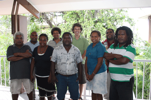
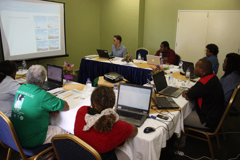
CSIRO scientist Tim Erwin presents a workshop on climate change projections and climate models at a PACCSAP workshop in the Solomon Islands. Credit: John Clarke, CSIRO
|
As well as advancing the knowledge of local climate change science, the program has focused on building the capacity of scientific organisations – such as national weather services – in each partner country.
The lack of capacity in many of these nations to plan and adapt to future changes in climate is a major barrier to them implementing relevant, useful climate change policy and planning.
So, as part of building more in-depth knowledge of past, present and future climate of the region – and making this accessible to the partner countries – CSIRO and BoM developed several Pacific-specific online tools. These include:
-
a Pacific Climate Change Data Portal, which provides access to historical climate trends and basic climate information
-
a Pacific Tropical Cyclone Data Portal, which provides detailed information and data on historical tropical cyclones
-
Pacific Climate Futures, which provides country-specific climate projections for a range of future emissions scenarios and time periods.
CSIRO and BoM scientists also provide relevant training and support to people from the partner countries, so they can use the tools to help run their own climate change projects. Over the past three years – and set to continue until at least 2013 – a raft of in-country visits, workshops, conferences, mentoring programs and ongoing contact has begun to help these Pacific nations help themselves.
These capacity-building initiatives mostly target people from the region’s national meteorological services (NMS).
‘We’ve focused our efforts on NMS because they are likely to work on this type of science in their day-to-day work,’ says Dr Murphy.
‘They have their own knowledge of their country’s weather and climate, so they can put it in the right context. They also provide climate information that’s used by other agencies doing climate change adaptation programs.’
Apart from training Pacific islanders to use the online tools, CSIRO and BoM scientists provide general training in climate change science and presentation skills – giving them the experience and ability to have a voice at international forums such as climate change conferences.
Another important aspect is funding people from the partner countries to spend time with scientists in Australia as part of a mentoring program.
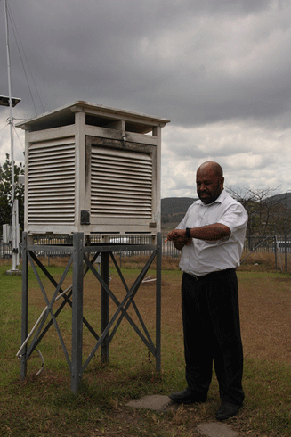
Last year, Kasis Inape, Assistant Director of the Papua New Guinea National Weather Service, spent six weeks in Melbourne working with BoM scientists. He gained experience in scientific analysis, producing reports and scientific posters, and writing papers. His experience helped him give a presentation on PNG’s climate variability at a recent climate conference in Noumea.2
Mr Inape describes his attachment experience as extremely worthwhile, especially the access he has been given to computing resources and expert knowledge.
‘Much of our work here [in PNG] is administration – we don’t do much of the science, because of the lack of infrastructure,’ he says. ‘When I was able to use the BoM resources, it was really exciting – we were able to produce results on the project I was working on.’
The experience Mr Inape gained with BoM will mean big improvements for his organisation, he says. ‘We do seasonal outlooks every month, we warn people about what’s happening to the climate; with this [new] information and knowledge, we can improve our forecasting, and be more accurate.
‘For example, I learnt that the El Niño and La Niña phases behave differently in different parts of the world; they are country-specific and site-specific. So, we no longer generalise that when we have an El Niño there’s going to be drought, or when we have La Niña it’s going to be wet.’
David Hiriasia, Director of the Solomon Islands Meteorological Service, has also gained valuable experience from workshops and training. Mr Hiriasia has just completed a second stage of training in the Climate Futures tool.
‘The tool will definitely be useful,’ he says. ‘We have lots of climate change projects, but the science part has been absent for some time. [Climate Futures] will improve our climate services – apart from just giving data, now we can actually do projects, analyse the data; it’s quite an improvement for our climate office.’
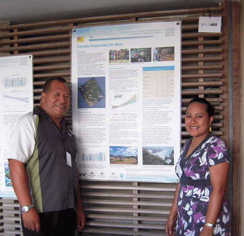
Niue’s Climate Change Project Coordinator, Rossy Pulehetoa-Mitiepo, agrees that the training is extremely valuable and has improved her technical skills in analysing her tiny country’s climate data.
‘The program will enhance our decisions and planning processes at all levels in the community and government for better adaptation in the future,’ she says.
CSIRO’s John Clarke, Project Leader of the Climate Futures projections tool, has been heavily involved in the training in all 15 countries. He explains that the tool can be used on three levels, depending on user knowledge and experience.
‘We run hands-on, self-paced training in a “train the trainer” style,’ he says. ‘The aim is that the people we train will feel confident enough to not only use the tool to develop their own national projections, but also be able to teach others in their country as well.
‘There’s varying capacity in different countries; some countries are already at that point of having the confidence to teach others, some are not quite at that point, and some might never get there; but that’s our aim.’
Having access to climate change information and knowing how to use it has already brought concrete benefits for some partner countries. One example is that of Tuvalu – a group of nine tiny, flat islands in the southwest Pacific, with a total land area of 27 square kilometres – where, as Dr Murphy describes, a recent drought highlighted the need to provide reserves of drinking water.
‘They are pretty reliant on the rain, as they’ve got nowhere to store the water in any natural lakes, because the islands are so small. So, they’ve started to put into place things like rainwater tanks.
‘The information that we provide on past and future climate and variability is very relevant for their projects. They need to know the likely outcomes, such as how much water do they need to store, and how long they are likely to be going between droughts.’
Although delivering training across 15 nations was not without its challenges, science program leader Kevin Hennessy says the success of the program so far has exceeded expectations and the key thing now is to maintain the momentum.
‘We’ve got a 2-year extension to the program now, and we’re already organising follow-up training visits,’ he says.
Adds Mr Clarke: ‘We knew up front that there was no way a single training course would get people up to speed with this stuff. We fully expected to come back, so that’s why we planned follow-up visits, and we’ll do the same again.’
More information
Pacific Climate Change Science Program
1 Climate Change in the Pacific: Scientific Assessment and New Research. Volume 1: Regional Overview; Volume 2: Country Reports
2 10th International Conference on Southern Hemisphere Meteorology and Oceanography


